
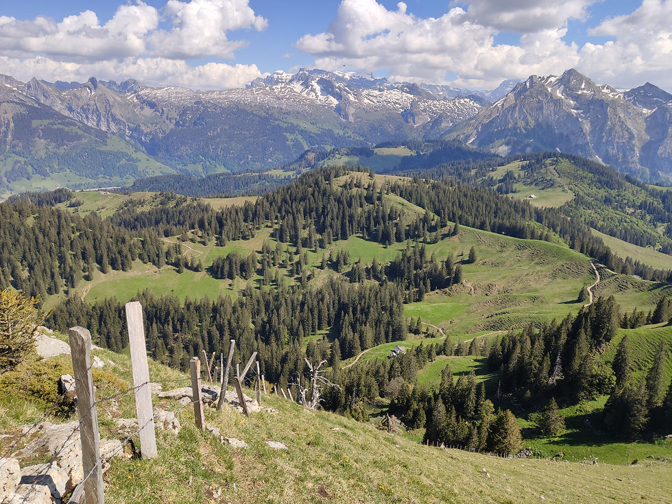
Chli Aubrig summit
- Marietta Galazka
- May 23, 2020
- 2 min read

Updated: Jun 29, 2020
Schwyz, Vorderthal


Distance: 9.75 km.
Walking time (summer time): 2h 45 min, but other sites suggest 3h 30min.
Elevation gain: 490 m.
Highest point: 1,642 m.
Access: Car.
Parking: at Sattelegg, Willerzell
This hike was very enjoyable and we highly recommend it! This loop hike can be done in both directions, however, we chose to do it the longer way to climb the summit (starting from East side). We passed quite a few families with kids or babies in backpacks. We even allowed our 16m old son to walk parts of this hike by himself.
Following our route, the scenic views start from the beginning of the hike. The route varies in width and ground cover from car-width and gravel covering to small rocky terrain with tree roots. A considerate amount of the route is overshadowed by trees and some parts of the hike go through the forrest. This is much appreciated in warmer weather! There were short sections of steep climbs, where we were glad to wear proper hiking shoes for a better grip. Deviating from the loop hike to the summit climb is highly recommended, but it is a rather steep incline. The top itself has 2 narrow pathways, but many people sat on the slope enjoying the view in front of them. The top is marked by a cross and it opens up stunning views into mountains from each side. On the way back from the top, there is a possibility of cutting the walk slightly shorter than coming back to the loop deviation point; but the shortcut is very, very steep and it may not feel as safe with a baby backpack or children. We went for the safer option of going back to the same point of where we left the loop hike. The route coming back was also very panoramic, starting with a singular track on the side of the slope and later becoming a wider gravel/tarmac road. This side included quite a number of steps.
Next to the parking, there is a restaurant point with scenic playground for kids. Our son seemed to enjoy playing there after the hike and meeting others in similar age group to him. There are a few benches on the route, but it is easy to find good spots on the grass next to the hiking pathway throughout this hike. The deviation point from the loop to the summit also has a fresh drinkable alpine water point to refill bottles. There were no obvious BBQ points, but there are plenty of possible BBQ spots around the area or surrounding lakes for a BBQ before/after-the-hike.
It is also possible to hike both summits on the same hike - Chli Aubrig and Grosser Aubrig.
This hike is also available with racquettes/snowshoes in winter. Saying this and having done a number of winter hiking routes; I don't think we would feel comfortable yet following this winter climb with our baby backpack.
More information about this hike can be found on SchweizMobil website here.


Comments